

Tracking Coastal Adaptation
Implementing CA’s Innovative Sea Level Rise Planning Database
 Higher sea levels are already affecting California’s 3400 miles of coastline, millions of coastal residents, economy, buildings, and critical infrastructure. Yet, oddly enough for a state that is a worldwide leader in climate change mitigation, California has only recently begun to focus seriously on sea level rise adaptation. Recent reports have cited a lack of preparedness and a dismal level of coordination between the many actors engaged in sea level rise planning on the California coast.
In response, the California Legislature recently enacted A.B. 2516, one of the state’s first laws designed to advance climate adaptation. A.B. 2516 directs the California Natural Resources Agency and Ocean Protection Council to develop an online database of actions taken by state agencies and selected other entities (e.g., ports, utilities, and airports) to plan for sea level rise. These entities must submit relevant information to the database biannually, at the implementing agencies’ request. Notably, A.B. 2516 was not accompanied by an appropriation of implementation funds and will sunset in 2018 (unless the legislature opts to extend its requirements). Nonetheless, this pilot project provides a valuable opportunity to track and assess how well prepared the state is to meet the challenges of coastal climate change. Additionally, the database will be the first of its kind; thus, choices about which information to survey and how to share it have the potential to influence the form and scope of future adaptation efforts in California and beyond.
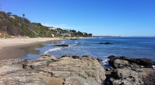
![]() A new report from UCLA Law’s Emmett Institute on Climate Change and the Environment explores how California can harness A.B. 2516 to enhance coastal climate change preparedness. Tracking Coastal Adaptation: Implementing California’s Innovative Sea Level Rise Planning Database, the latest Pritzker Environmental Law and Policy Brief, offers recommendations on the content, format, and functionality of the new database, including potential survey questions and preparedness indicators to incorporate. With contributions from leading experts in coastal law, climate change adaptation, program evaluation, and survey research, co-authors Susi Moser (Susanne Moser Research & Consulting/Stanford), Sarah Newkirk (The Nature Conservancy), and I outline a vision of how California can most effectively harness A.B. 2516 as a cornerstone of the state’s sea level rise adaptation efforts, while educating the public about our preparedness for coastal hazards.
A new report from UCLA Law’s Emmett Institute on Climate Change and the Environment explores how California can harness A.B. 2516 to enhance coastal climate change preparedness. Tracking Coastal Adaptation: Implementing California’s Innovative Sea Level Rise Planning Database, the latest Pritzker Environmental Law and Policy Brief, offers recommendations on the content, format, and functionality of the new database, including potential survey questions and preparedness indicators to incorporate. With contributions from leading experts in coastal law, climate change adaptation, program evaluation, and survey research, co-authors Susi Moser (Susanne Moser Research & Consulting/Stanford), Sarah Newkirk (The Nature Conservancy), and I outline a vision of how California can most effectively harness A.B. 2516 as a cornerstone of the state’s sea level rise adaptation efforts, while educating the public about our preparedness for coastal hazards.
Some of our key recommendations include:
- Collect data that—whenever possible—is quantifiable and relates to metrics regarding entities’ adaptation capacity, actions, and progress.
- As resources allow, design a user-friendly database that enables users to view relevant geospatial information in interactive maps.
- Secure funding and legislative authorization to maintain the database indefinitely and expand data collection over time to include an even broader scope of coastal entities (e.g., local governments, coastal businesses, universities, and hospitals).
As we note in the report,
A fully functional and comprehensive sea level rise planning database ultimately should be able to help answer questions like: What is the state of adaptation in coastal California today?, What exactly are coastal entities doing to adapt to climate change?, Is California adequately equipped with the tools necessary to undertake adaptation?, Are we doing enough to prepare for the impacts of climate change?, and Where do we need to focus attention and resources to make more progress so that all Californians are protected and can continue to live prosperous lives in the face of change?
We hope that over the next two years, the database will emerge as a useful tool for informing coastal resilience efforts and position California as a national leader.
The Ocean Protection Council is currently soliciting stakeholder input on implementation of A.B. 2516. You can review and comment on draft survey questions for the first round of data collection through May 20, 2015.
About the Pritzker Environmental Law and Policy Briefs. The Pritzker Environmental Law and Policy Briefs are published by UCLA School of Law and the Emmett Institute on Climate Change and the Environment in conjunction with researchers from a wide range of academic disciplines and the broader environmental law community. They are made possible through a generous donation by Anthony “Tony” Pritzker, managing partner and co-founder of The Pritzker Group. The briefs provide expert analysis to further public dialogue on issues impacting the environment.
Reader Comments
3 Replies to “Tracking Coastal Adaptation”
Comments are closed.
Related Posts


About Megan
As the Emmett/Frankel Fellow at UCLA School of Law from 2012 to 2016, Megan Herzog taught and researched environmental law and policy issues for the Emmett Institute on C…
READ more
“….Recent reports have cited a lack of preparedness and a dismal level of coordination between the many actors engaged in sea level rise planning on the California coast…..”
No one knows for sure many millimeters that sea level may have risen in California or if sea level has risen at all? Tectonic forces may be pushing California’s landmass upwards and thereby offsetting any minute change in sea level. Rising sea levels are not a real crisis, but merely another component of the hysteria, misinformation and politics that surround the nebulous issue of climate change.
Ho-hum.
Okay, you don’t know – no one does – what the future will bring, but you want to offer your advice on what to do about one possible scenario – rising sea levels.
What are you going to do, what kind of reparations are you going to provide, when the predictions you are accepting as true prove to be wrong? You do recognize, do you not, that you are participating in a “central planning” exercise in where to spend tax money, how to regulate private property, how to control – interfere with – human actions?
How are you and your co-authors going to make up for the damages to which you contribute?
BQRQ and Mr. Grant: Amazing how people can arrive at conclusions merely by confirming their own biases, no? You might almost think that some writers avoid the substance of the topics they are discussing because doing so would interfere with the comfortable process of re-affirming their preconceived notions…
Megan: The user-friendly, interactive map sounds like a great idea. The White House Office of Science and Technology mentioned some data and projects growing up along the lines of that suggestion in a December 9, 2014 press release:
https://www.whitehouse.gov/sites/default/files/microsites/ostp/cdi-ecosystems-12-9.pdf
If Float (mentioned on page 3 of 5) succeeds at scaling up to include the California coast we may be several steps closer to the type of interactive map you and your co-authors endorsed.