The “Silver Bullet” Required to Improve California’s Water Rights System: More & Better Data
California Lags Behind Other Western States in Obtaining Critically-Needed & Available Water Diversion Data

Recently I’ve posted stories about efforts to enforce California’s water laws in the face of efforts by some diverters to evade and ignore limits on their ability to privatize public water resources–especially in times of critical drought. One post focused on the federal government’s successful criminal prosecution of a San Joaquin Valley water district manager who illegally diverted millions of gallons of water from the government’s Central Valley Project for more than two decades. Another commentary discussed long-overdue California legislative efforts to increase financial penalties for violations of state water curtailment orders like those by diverters on the Shasta River who ignore severe drought conditions for their private gain.
Such federal and state enforcement efforts are critically important if California’s scarce water resources are to be allocated fairly and equitably among competing water users and needs. But a chronic deficiency of California’s water rights system is the absence of comprehensive and timely reporting of water diversions throughout the state. Without such data, state and federal water regulators can’t administer and enforce water rights systems effectively and on a timely basis.
Nearly a decade ago, the California Legislature enacted a law (SB 88) requiring any surface water user who diverts at least 10 acre feet of water per year to install and maintain equipment to monitor their diversions, and to report them to the State Water Resources Control Board on at least an annual basis.
Problem solved, right?
Unfortunately, no. The 2022 Sacramento Bee article that broke the story of the illegal Siskiyou County water diversions from the Shasta River also reported that the 2015 legislation has largely been ignored by the state’s water users. The Sacramento Bee story revealed, shockingly, that only 11% of California’s urban and agricultural users have actually complied with SB 88’s water monitoring and reporting mandate.
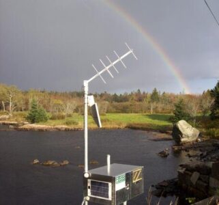
The result? According to the Bee expose’, “a state regulatory system dramatically unprepared to address chronic water shortages and an ecosystem collapse.” The article reports that “California continues to lack a robust system for metering water flowing through its rivers.” The Bee story finds there are only 1,000 functioning stream gauges on a state river system that’s 189,454 miles long. And a relevant report by a consortium of state agencies acknowledges that the shortage of gauges “results in data gaps that hamper effective management of California’s limited water resources.”
This state of affairs also results in an inconsistent and unfair California water rights system: the 89% of water users who ignore the state water monitoring/reporting law have an unfair advantage over the 11% who comply with it.
The ongoing deficiencies of surface water monitoring and reporting of data in California are underscored by an important, new report by U.C. Berkeley researchers Ted Grantham and Lucy Andrews, scholars at the campus’ Department of Environmental Science, Policy and Management. Their research reveals “substantial gaps in [California’s] stream monitoring network.” According to their analysis, only 8% of the state’s complex system of rivers and streams is currently monitored by stream gauges. The authors aptly note, “As climate change progresses and the demands on California’s water resources and water infrastructure grow, it is critical to have reliable, timely, and comprehensive information about water in rivers and streams.” The U.C. Berkeley report provides an excellent set of recommendations for state policymakers and water regulators as to how these monitoring deficiencies can and should be corrected.
Two postscripts: first, California can take justifiable pride in its national and world technological leadership in many other fields. So it’s both ironic and disturbing that modern computer and satellite technologies have not been comprehensively deployed when it comes to California water monitoring and reporting. The sad fact is that many other Western states are far more advanced than California in doing just that. Utah, Colorado and New Mexico–states from which California could learn a great deal when it comes to comprehensive deployment of water monitoring technology–provide existing models for California to follow.
Second, this post focuses on surface water monitoring and reporting. But available technologies similarly make it possible to accurately assess groundwater extractions and aquifer depletions. It’s remarkable that California’s landmark Sustainable Groundwater Management Act (SGMA), enacted in 2014, does not require groundwater monitoring data to be collected and reported for the state’s chronically over-drafted groundwater basins. (SGMA does allow locally-formed Groundwater Sustainability Agencies to require groundwater monitoring within their districts, but does not mandate that they do so.) In a rational water rights system, water monitoring and reporting systems would be modernized and comprehensively deployed for both surface water diversions and groundwater pumping.
What is California waiting for?
Reader Comments
2 Replies to “The “Silver Bullet” Required to Improve California’s Water Rights System: More & Better Data”
Comments are closed.


Overall, stream gages are a more effective way to understand water availability and protect fisheries than individual diversion information. Unfortunately SB 88 (a trailer bill that never went through policy committees) failed to acknowledge that most farms are in rural places with no or limited electricity and connectivity. Also, metering devices are expensive (3-5k each), difficult to maintain and get clogged up/break down frequently. That’s why estimations using satellite data are a better way to get an idea of use on most farms. Yes, we need data to manage water more effectively, but there should be efforts to prioritize getting more aggregated datasets that cover MOST of water used, that is actually useful, and that takes into account feasibility for our rural farmers.
(FYI, USGS uses spelling of “gage” instead of “gauge”.)
When I was an undergrad I was working with a grad student on understanding how to predict climate change impacts on surface water supplies by deriving evapotranspiration (ET) by using stream-gauge networks and using remote-sensing data on temperature & rainfall data, running it through a simple water balance equation, and running regression analyses. The issue with this is that we could only make long-run projections because we had no groundwater data. Now with the GRACE satellites up since 2018, we can start using growndwater data to run more short run analysis, though of course it will take some time to get enough data to create a more robust model. The significance of being able to make shorter run projections by regional streamgauge and rainfall data, is that we can start to understand how water managers may need to change their methods to attain robust enough data to make accurate projections while taking into account climatic changes. I am hoping we can make strides on this now. I would love to work on it but I’ve recently graduated with an MS in public and urban policy so of course I have no funding. Are there any projects that someone with a GIS and remote sensing and public policy training could work on this issue?